Diller Scofidio + Renfro, Laura Kurgan, Robert Gerard Pietrusko, with the Columbia Center for Spatial Research
In Plain Sight
In Plain Sight. Photo © Tom Harris. Courtesy of the School of the Art Institute and the University of Chicago.
In Plain Sight. Photo © Tom Harris. Courtesy of the School of the Art Institute and the University of Chicago.
In Plain Sight. Photo © Tom Harris. Courtesy of the School of the Art Institute and the University of Chicago.
In Plain Sight. Photo © Tom Harris. Courtesy of the School of the Art Institute and the University of Chicago.
Hannah Arendt once said, that “only with a completely organized humanity could the loss of home and political status become identical with being expelled from humanity altogether.”[^1]
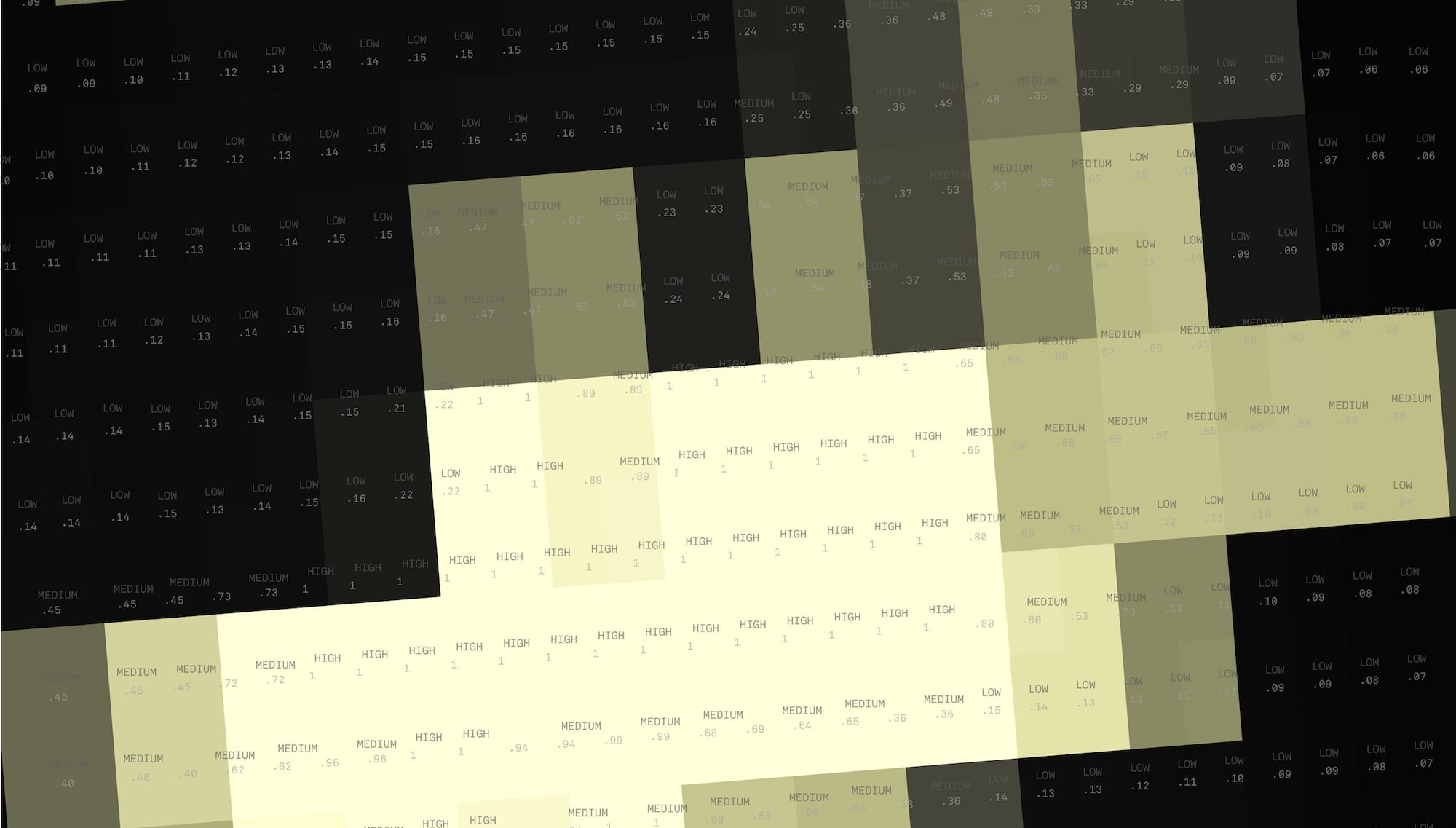
Today, using the best technologies available for data collection, we are able to see settlements and count their populations. Registering the sites of exclusion and expulsion—the places of refuge and resistance—presents a powerful challenge, however. In a world of would-be global citizens, do we truly know where our fellow citizens live? And if we don’t, how can we make them count?
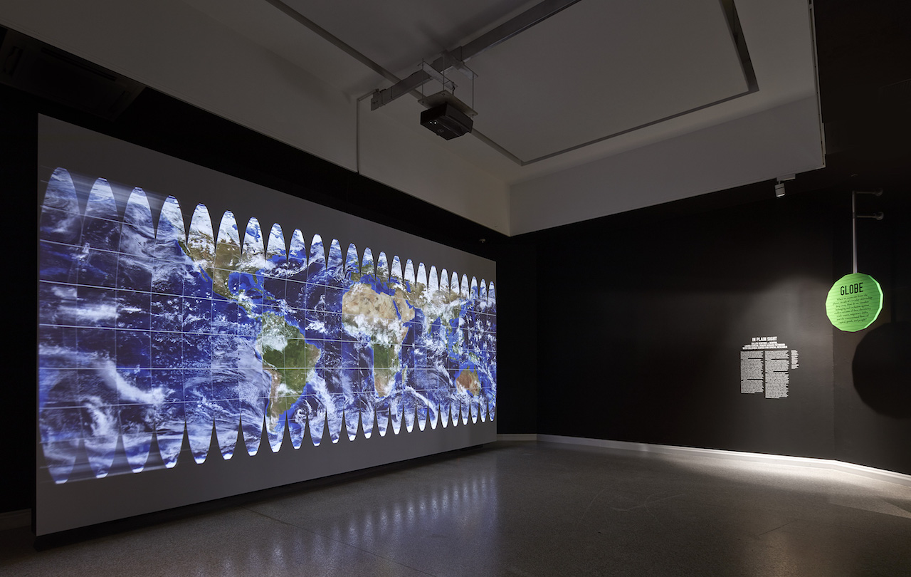
This is a question of representation. Twice a day, twelve hours apart, a new image of Earth is scanned and saved by the Soumi National Polar Partnership satellite and its sensors. The 1:30 p.m. daytime image, assembled from data gathered over a number of days, shows a cloudless Blue Marble. The 1:30 a.m. nighttime image, similarly composited, forms a Black Marble, a cloudless view of lights across the planet. The sensors can observe light in extraordinary detail, all the way to the level of a traffic lamp or a fishing boat. According to NASA, “the sum of these measurements gives us a global view of the human footprint on the Earth.”
In 1972, the Blue Marble photo of Earth from Apollo 17 marked a paradigm shift: the image of a solitary sphere floating in space became the icon of a unified, borderless, and vulnerable planet, and catalyzed an appeal to a global “humanity” around something natural that we all share and that binds us together. Without frontiers, it demands of us another kind of stewardship or citizenship, beyond the law and the state, a status that has no legal standing but an often powerfully affective one.
Forty years later, the Black Marble became the new portrait of our planet. While more binary and less textured in form, it provided us with evidence of the extent of the human footprint on the planet. According to NASA, it “shows [us] where the major population centers are and where they are not.”
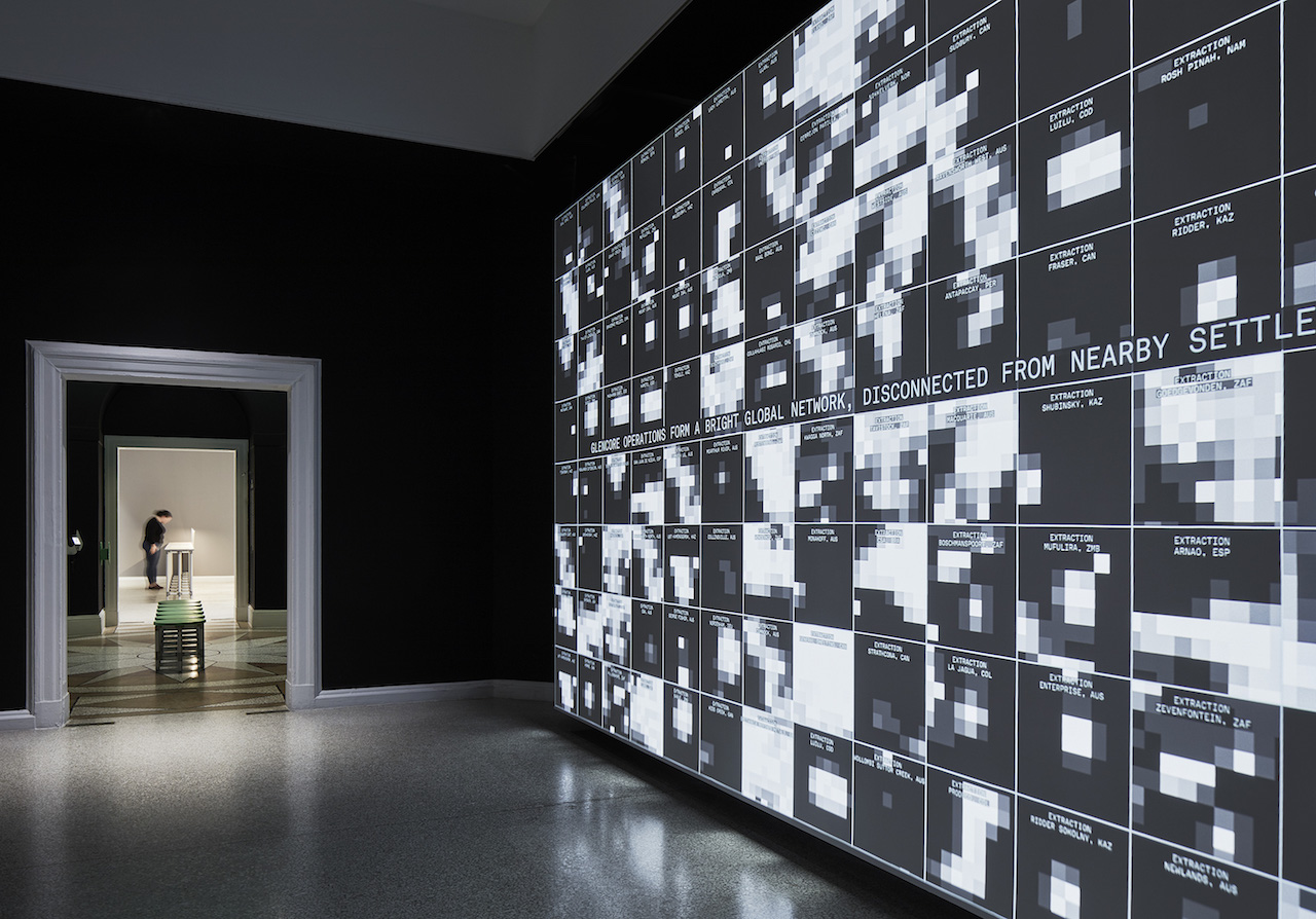
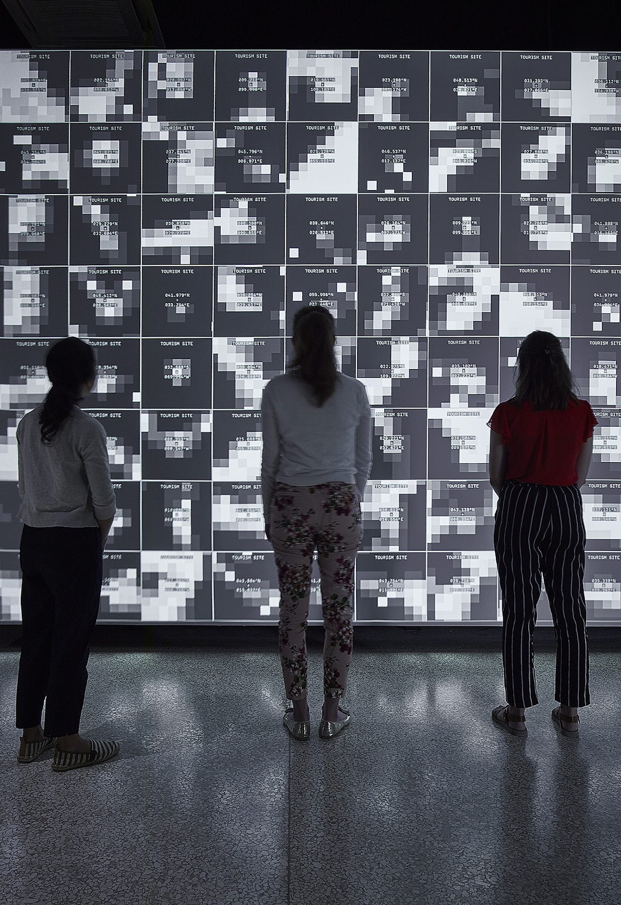
For Marshall McLuhan, the great technological and mediatic revolution came in the form of electric light. The Black Marble puts this in simple on-off terms: Either there is light, or there is not. Where McLuhan saw “electrical contraction” and the emergence of a global village, NASA sensors show us the gaps in the network, the individual lights and the zones where lights are missing. And the image doesn’t simply represent this world—it actively constructs it. As evidence, the Black Marble imagery is put to work by a range of political and economic actors to craft policies and interventions organized around a set of parallel binary oppositions: urban-rural, developed-undeveloped, and rich-poor.

Blue Marble, 2002; Black Marble, 2016. © Courtesy Godard Space Flight Center
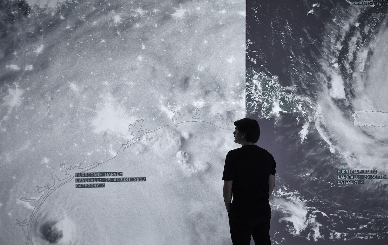
In Plain Sight reveals anomalies and the consequent perils at the core of this binary world view. Visitors are shown places in the world with many people and no lights, and those with bright lights and no people, and are suspended between day and night and light and darkness—exposed to the political and social realities of being invisible in plain sight.
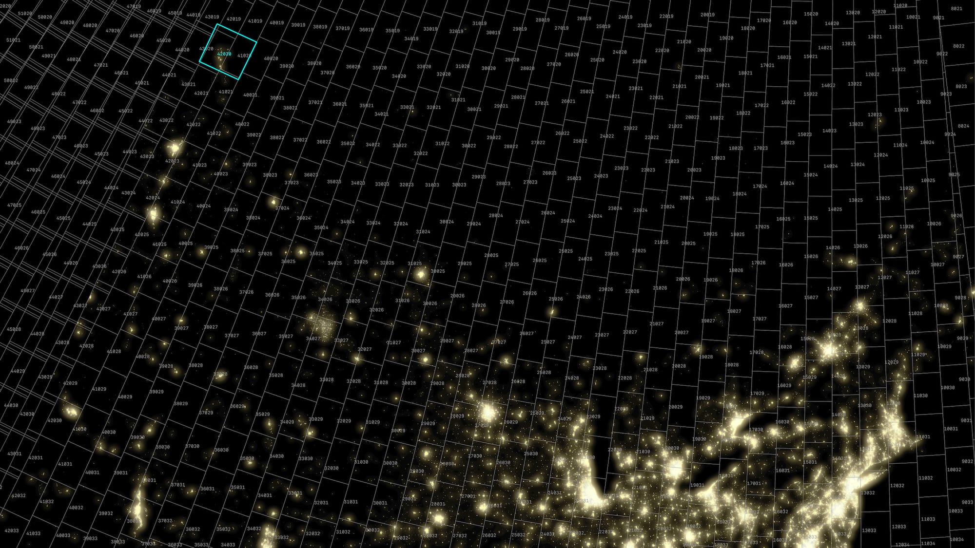
Nighttime lights, Canada and Northern United States. 1: 6,000,000. © Courtesy Godard Space Flight Center
Nighttime lights, Athabasca oil sands, Alberta Canada. 1:11,000. © Courtesy Godard Space Flight Center
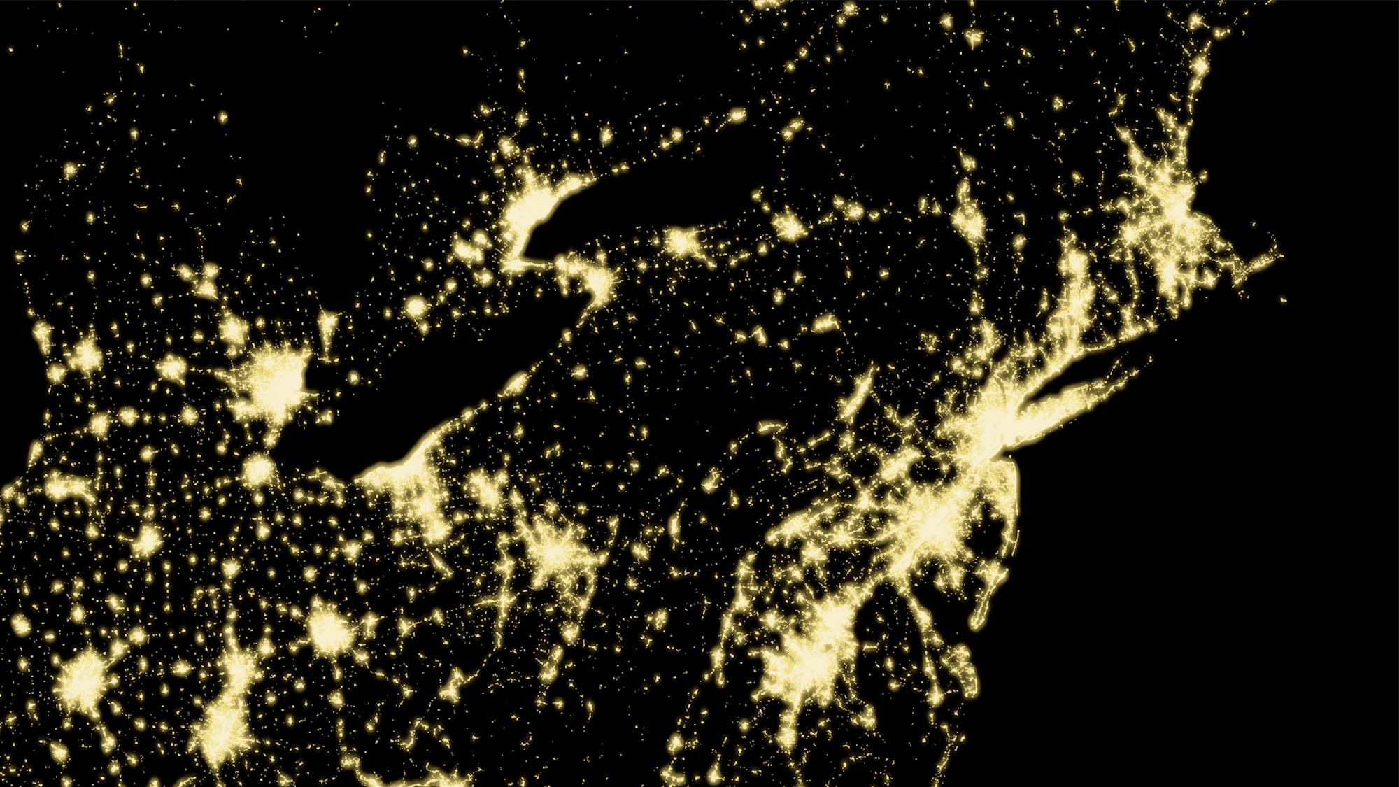
Nighttime lights, Eastern United States. 1:200,000. © Courtesy Godard Space Flight Center